Geographical Mask Block
The GeographicalMask outer block splits a domain into separate regions
(in the adjoint application) so that separate covariances can be applied to the
different regions. The separate regions are then recombined in the forward
application of the block.
To calibrate the block (i.e. create the geographical masks) a “mask” field is
read from a user-specified variable in a file (can be a model file - like a
background or first guess - or a user provided file with desired mask). The user then
specifies the conditions for the mask using relational operators (<, <=, ==, !=,
>= or >) and thresholds. In calibration mode the masks can be written out
into a form that can then be read in later (when the block is in read mode).
Filtering can also be applied to smooth out sharp cutoffs.
For example, if the latitude can be read out of a model file, then a mask separating the domain into latitude bands could be created. In the examples that follow, a land/sea split is used. See [MM11] for another example using this feature for data assimilation of fog events.
Example
The example below separates the air_temperature variable in to
separate air_temperature_land and air_temperature_sea
regions using the landmask variable read from a model file
in which grid points over land have a value of 1 and points over
water have a value of 0.
saber outer blocks:
- saber block name: GeographicalMask
  active variables: [air_temperature]
  calibration:
    masks:
    - suffix: _land
      relational operator: ">="
      threshold: 0.5
    - suffix: _sea
      relational operator: "<"
      threshold: 0.5
    mask variable: landmask
    input mask file:
      overriding variables: [landmask]
      filename: <path/to/model_file>
      date: *date
For a specific example for a landmask from a 480km mpas model file,
see Landmask for 480km MPAS grid.
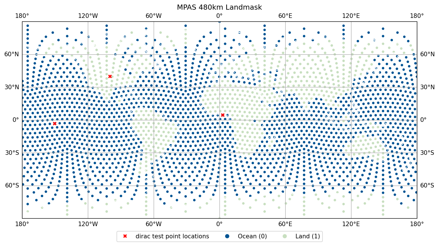
Fig. 4 Landmask for 480km MPAS grid
A demonstration of a dirac test using the Explicit Diffusion central block correlation operator (with a longer correlation lengthscale over water than over land) is shown below (the locations of the dirac points are indicated in Landmask for 480km MPAS grid).
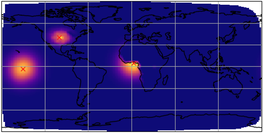
Fig. 5 Dirac test using ExplicitDiffusion central block and GeographicalMask to split land/sea regions.
The dirac point off the western African coast shows that covariance is NOT spread across the domains.